
Geospatial Analysis and Predictive Modelling of Mpox Transmission Hotspots: A Case Study of Ogun State, Nigeria
Status: Journal pre-proof · Accepted 11 October 2026 · Open access (CC BY-NC-ND 4.0)
Authors: Adesina Simon Sodiya, Samuel Onuche-Ojo Egwu*, Dada O. Aborisade, Saheed Akinbowale, Mary Idowu Olasoju (*corresponding author)
Journal: Scientific African (2026), article e03698
DOI: https://doi.org/10.1016/j.sciaf.2026.e03698
Abstract
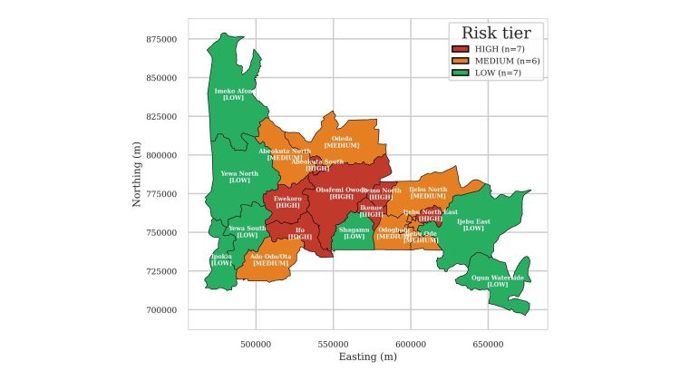
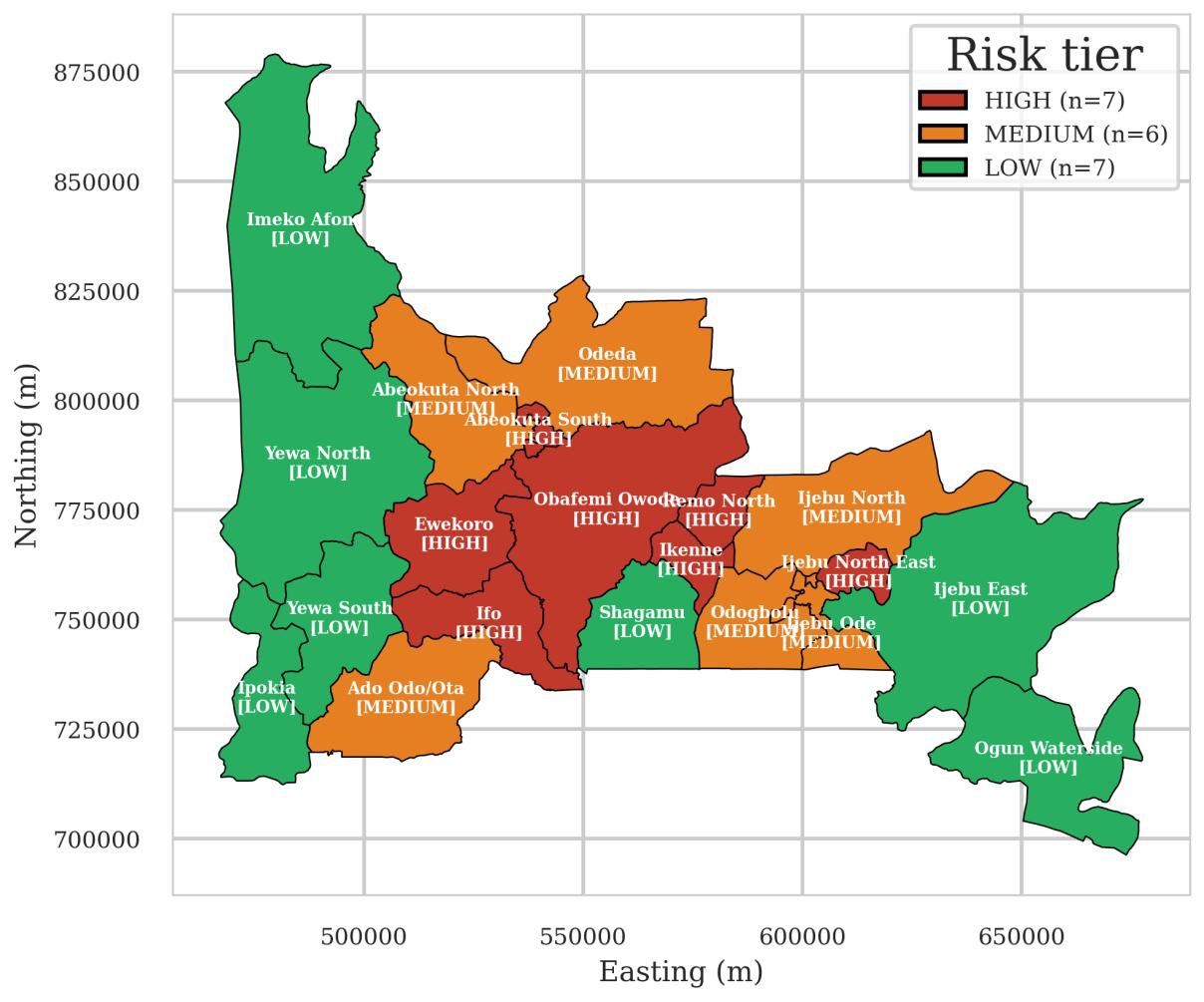
Mpox is a recurring public health threat in Nigeria and was re-declared a Public Health Emergency of International Concern in August 2024. Nigeria’s Integrated Disease Surveillance and Response system operates at the Local Government Area (LGA) level, yet published mpox risk models resolve risk only at state level, forcing uniform deployment across heterogeneous LGAs. This study developed and evaluated an LGA-resolution geospatial risk layer for the 20 LGAs of Ogun State and integrated it, as a proof of concept, into a live surveillance platform. State-level records of 40 laboratory-confirmed cases (NCDC, 2022) and 151 suspected cases (Ogun State Ministry of Health, 2022–2024), 191 in total, were spatially disaggregated into 189 pseudo-presence points and modelled with an ensemble of maximum entropy, random forest, and extreme gradient boosting over 100 bootstrap replicates. Discrimination was good under random hold-out (AUC 0.77; Boyce index 0.99) but fell under spatially blocked cross-validation (AUC 0.57), indicating that the layer is suited to coarse triage between tiers rather than within-tier ranking. Seven LGAs were classified high risk along a central corridor anchored on Abeokuta South and the Ijebu–Remo axis, six medium, and seven low. The tiered layer was exported as GeoJSON with tier-specific action packages and integrated into the IDS-Master platform as a proof-of-concept pathway from spatial epidemiology to routine public health surveillance. Because the 189 points were disaggregated from aggregate counts rather than individually geolocated, the tiers should be read as a spatial prior for triage rather than confirmed case locations.
Keywords: Mpox; Ecological niche modelling; Ensemble machine learning; Spatial epidemiology; Disease surveillance; One Health
Related project
This study is part of our AI4MPOX work. The resulting LGA-level risk layer has been integrated into IDS-Master, our intelligent disease surveillance platform, as a proof of concept for routing surveillance resources in Ogun State.
How to cite
Sodiya, A. S., Egwu, S. O.-O., Aborisade, D. O., Akinbowale, S., & Olasoju, M. I. (2026). Geospatial Analysis and Predictive Modelling of Mpox Transmission Hotspots: A Case Study of Ogun State, Nigeria. Scientific African, e03698. https://doi.org/10.1016/j.sciaf.2026.e03698